Un viaje a la parte más occidental de la Unión Europea

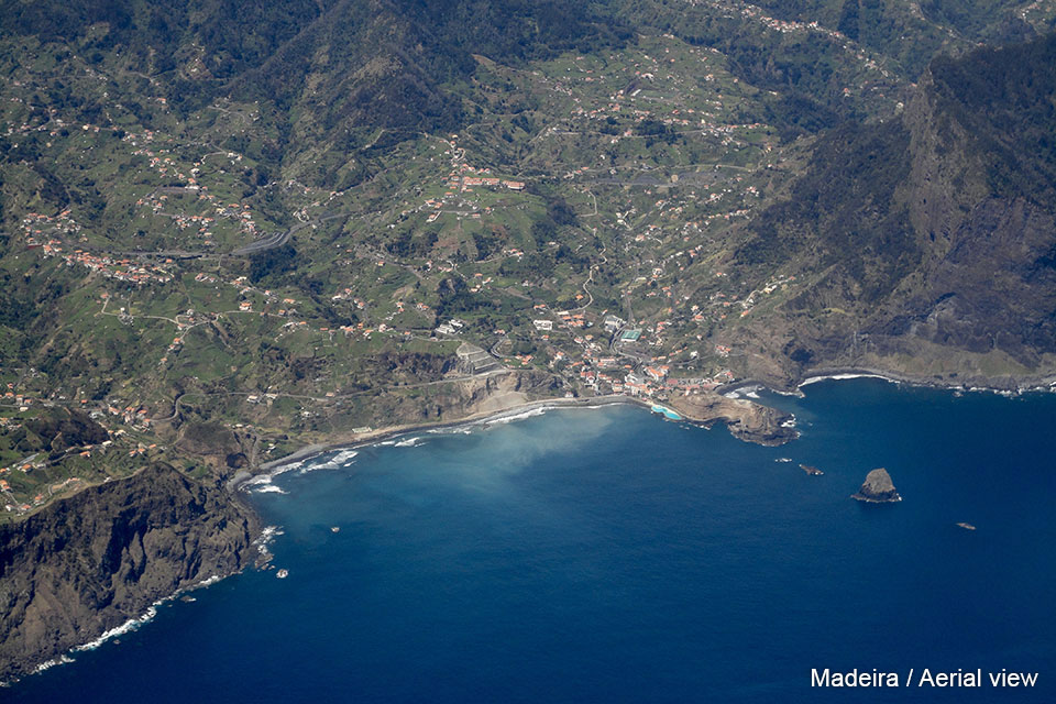
The Azores are a group of islands (fairly small), located in the North Atlantic Ocean. If a line is drawn between Lisbon and New York, the distance will be a quarter of that line between Lisboa and the Azores and three quarters between the Azores and New York. The Azores are part of Portugal and therefore they are included in the European Union. The same happens with the Portuguese islands Madeira and Porto Santo, located at the further south and more closed to the coast of Africa.
The Azores were discovered by the Portuguese 50 years before the arrival of Columbus to America. As in the time of its discovery they were uninhabited, it was rather easy for Portugal to incorporate them to its kingdom. Due to their location on the Atlantic Ocean, they had been wanted by other European powers but the alliance between England and Portugal made their possession not to run big risks.
What is strange (if one looks the map of the Atlantic Ocean) is that the Azores were not used as a base for the first trips of the discoverers of the XV Century, during their trips towards America. The reason is that the stronger current (East to West) of the North Atlantic Ocean is quite more to the south at the same latitude of Canary Island. This had been considered previously by Colon, who had been in the Canary Island to investigate the best route for his planned trip to India and when then, he finaly arrived in America.
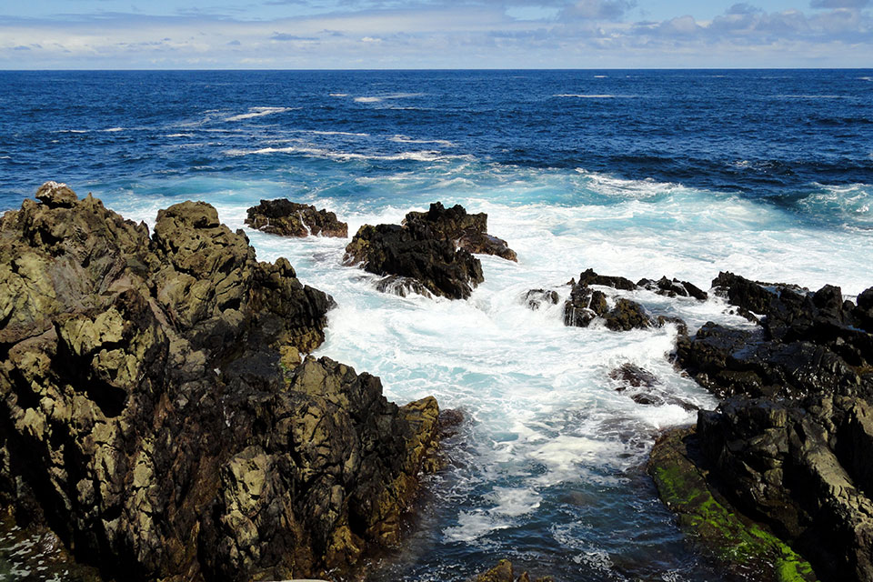
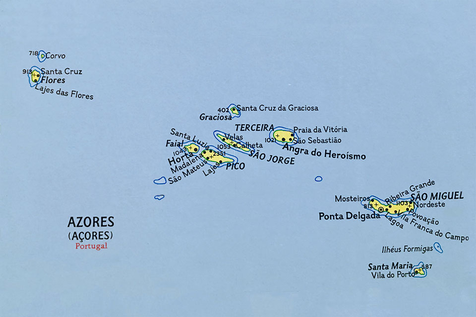
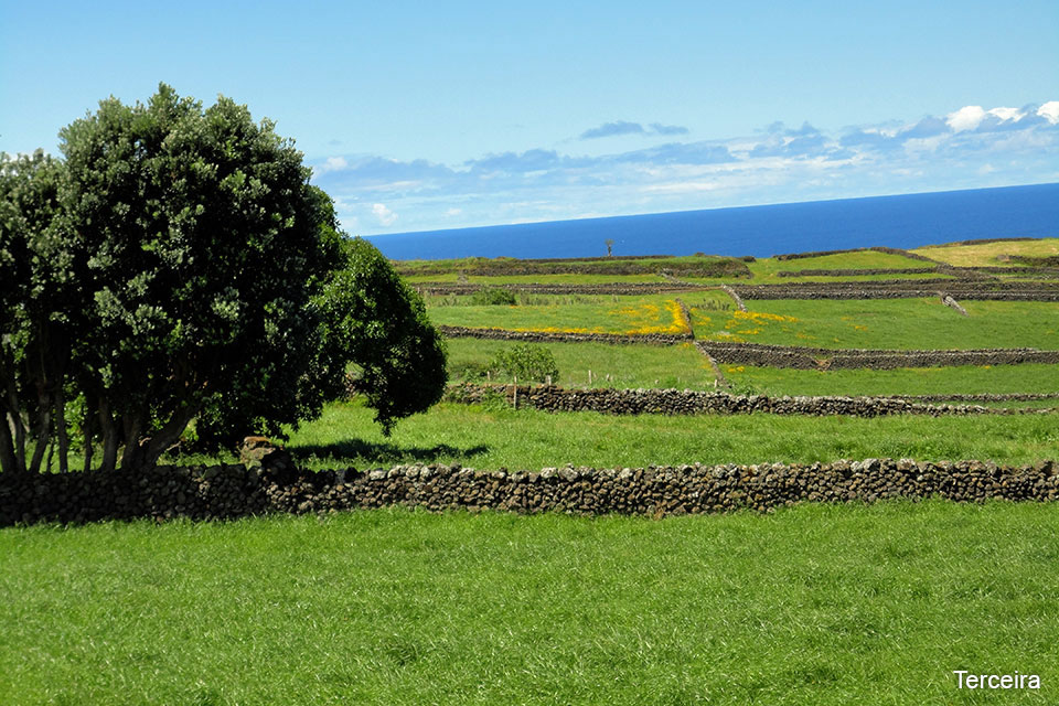
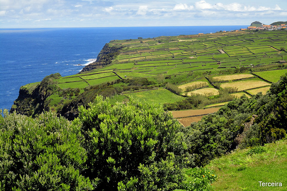
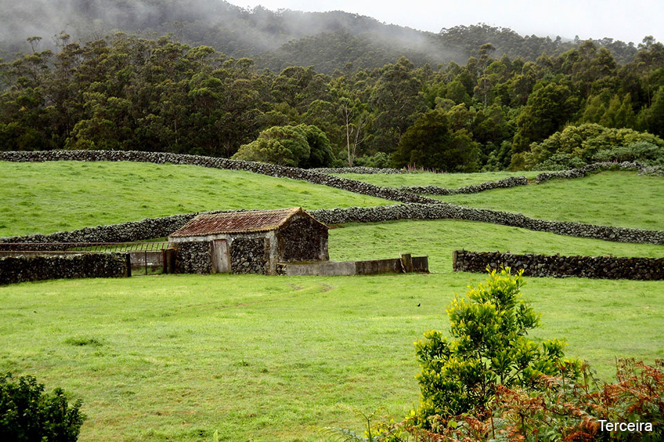
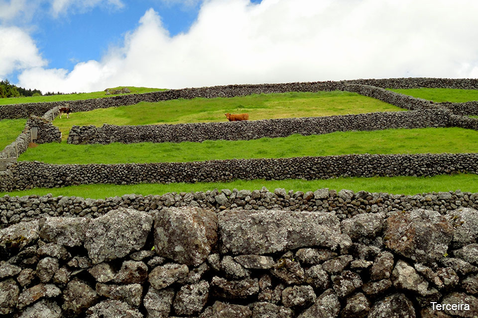
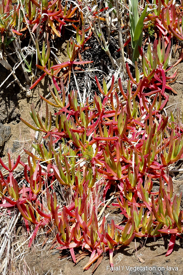
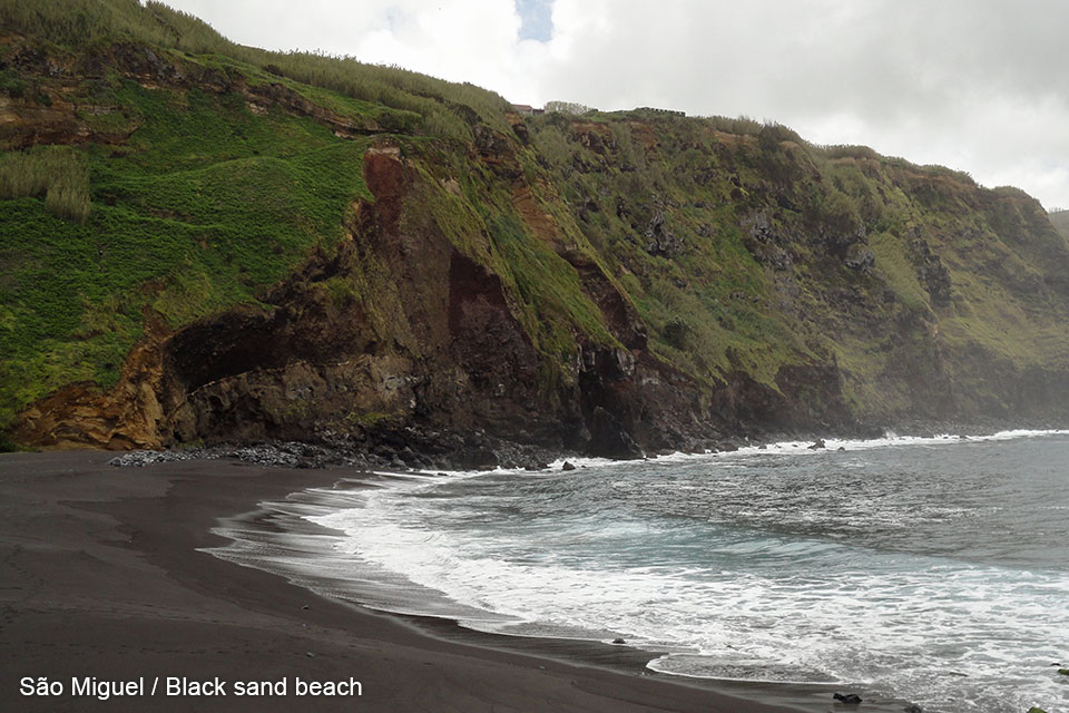
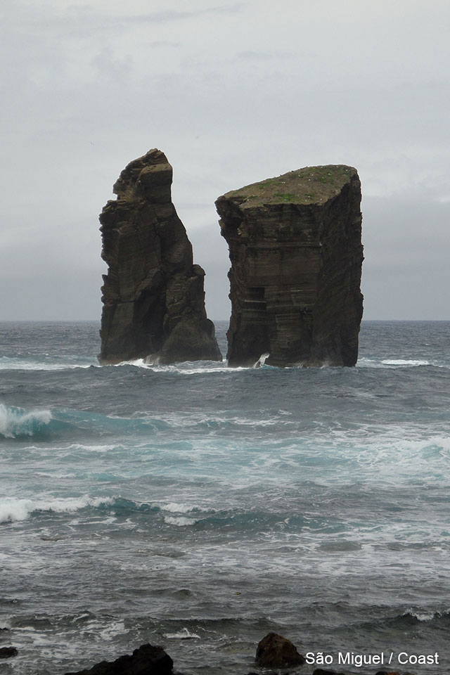
The nine Azores Island are grouped in three sets: the ones at the East are: Sao Miguel and Santa María; the ones at the center are the islands of Terceira, Faial, Pico, Graciosa, and Sao Jorge, being the more remote to the West the island of Flores and Corvo. The rural and marine landscapes are beautiful. The weather is unpredictable and changeable during the day. The predominant color is green of the exuberant vegetation and in their coasts, the color of rocks and the sand is almost black, because of the great volcanic activity.
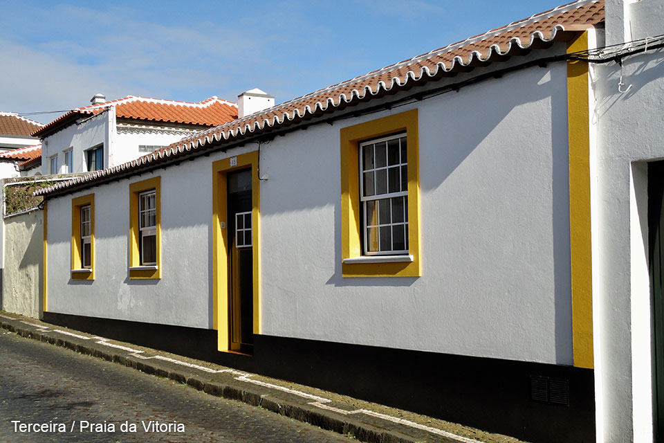
TERCEIRA
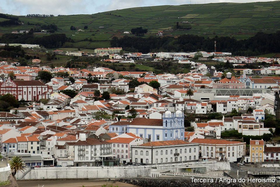
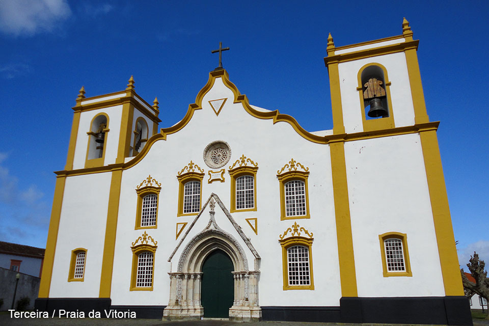
In Terceira there are two visible urban cores. One is Angra do Heroismo, that is its capital and that is full of Portuguese colonial buildings and, at the other side of the island is the village of Praia da Vitoria, that also has an area of colonial constructions.
Next to Praia da Vitoria there is a third populated area, which is almost invisible, as the access to it is very guarded, which is the huge United States Air Force Base of Lajes, that is of great strategic importance for the NATO to maintain control over the North Atlantic Ocean. In this enormous base, there are uncountable sets of houses for the military staff with all their families included, next to the military installations. We have seen the North American militars going out on their days off, with their Filipino and Japanese wives and their children (half American and half Asiatic), proof that they previously had been in military bases in other parts of the world.
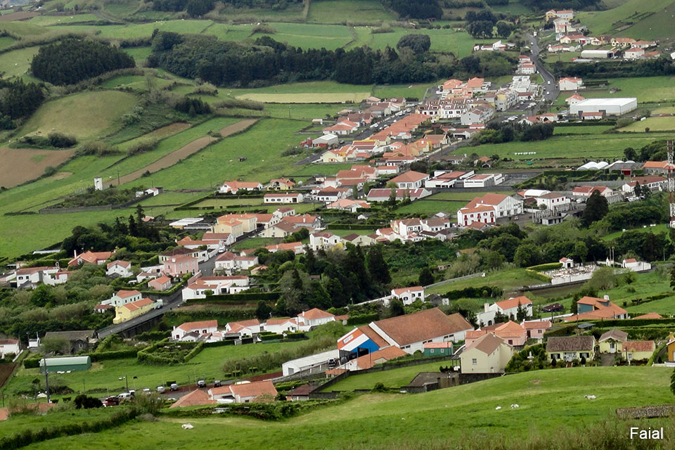
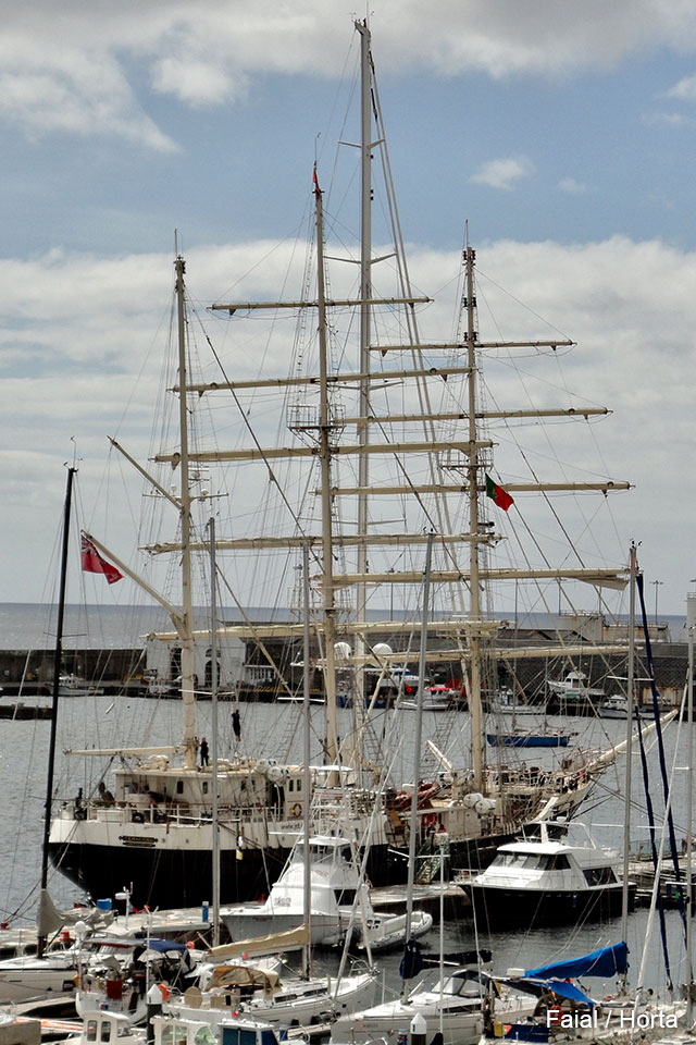
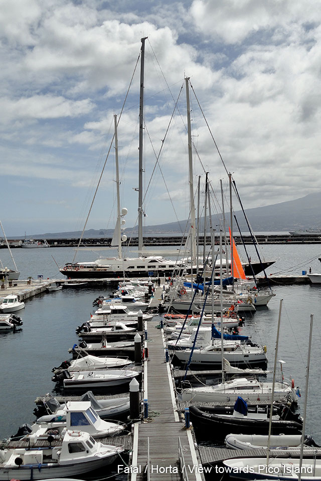
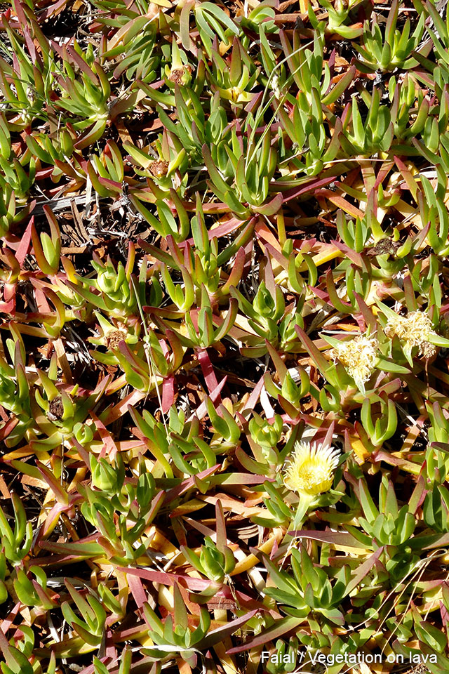
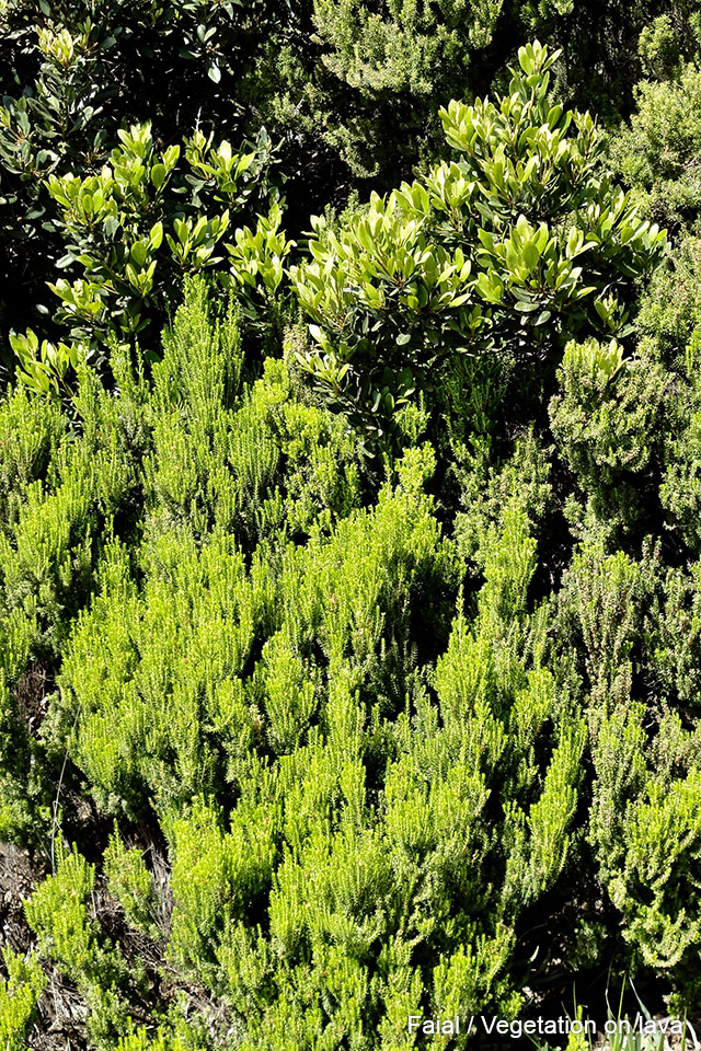
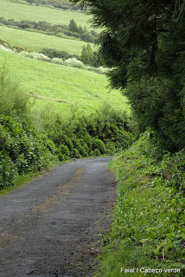
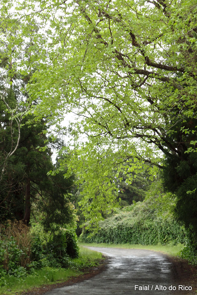
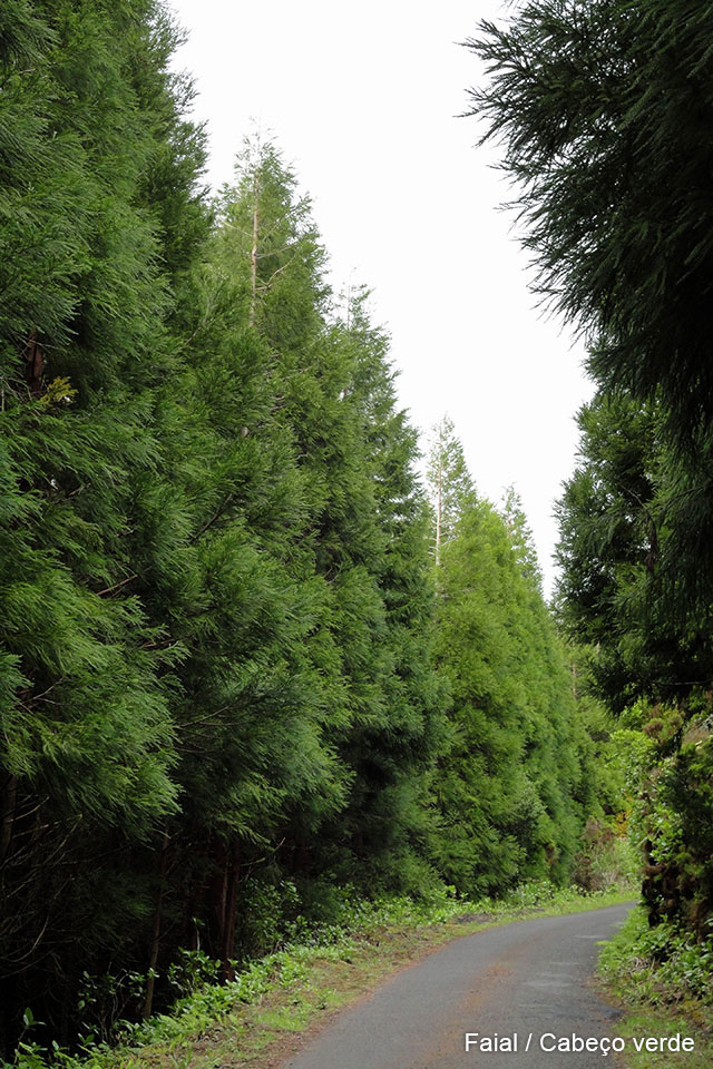
FAIAL
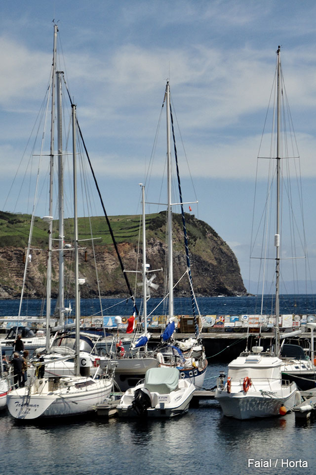
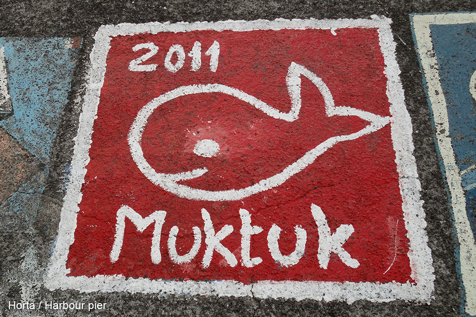
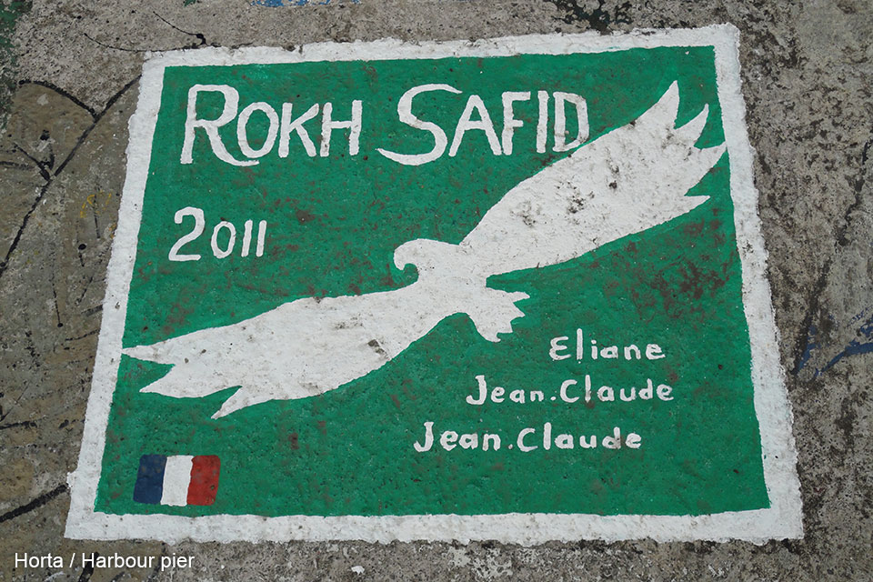
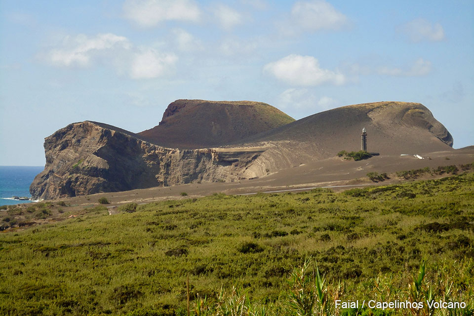
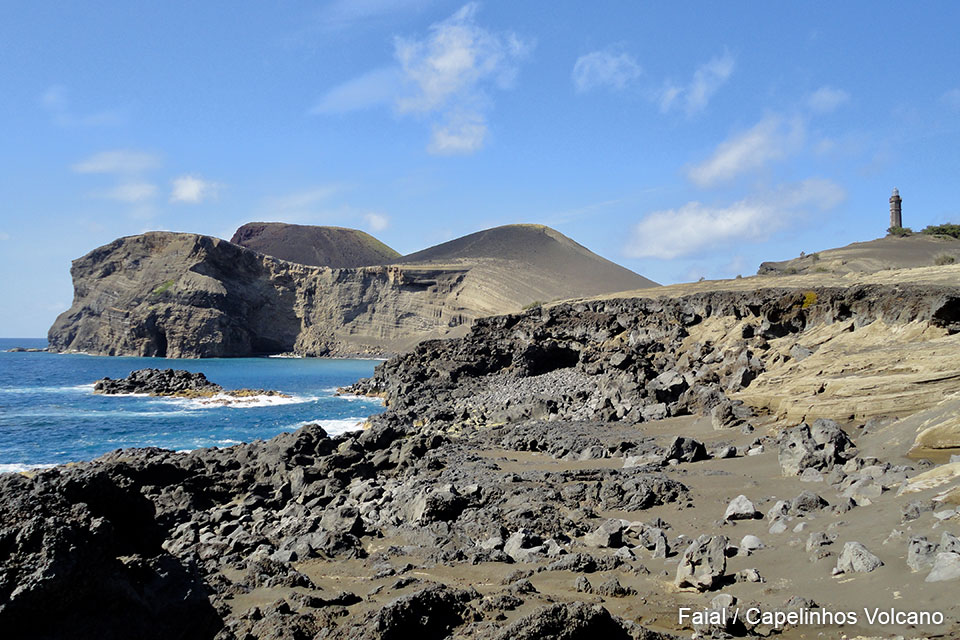
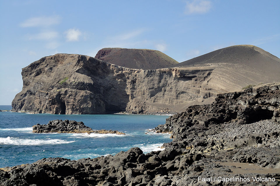
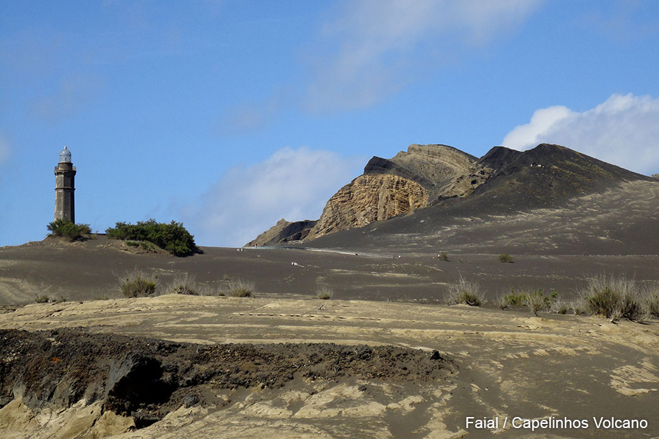
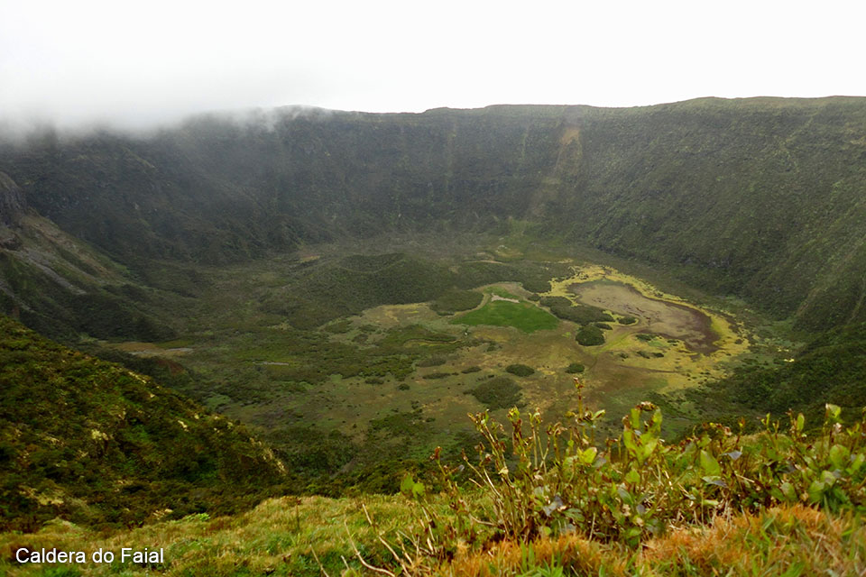
Many sailboats stopover in the port of Horta in their trip to cross the North Atlantic Ocean. On the floor of the stone pier, each member of the crews leaves its allegorical drawing, leaving a record of having made the ocean crossing. In the island, there are two impressive volcanic scenarios. One of them is the “Caldera do Faial”, to which it can be almost reached by car, until being in front of the hole of the extinct volcano. We went up on a very rainy day, between the clouds that almost did not let see anything. Once up, the clouds rose and the huge crater could be completely seen. The other scenario is on the coast where, in 1957, there had been an enormous eruption of the Capelinhos volcano. This event completely changed the appearance of that part of the island, so much so that the coastal lighthouse was displaced several hundred meters from its original location by the shore.
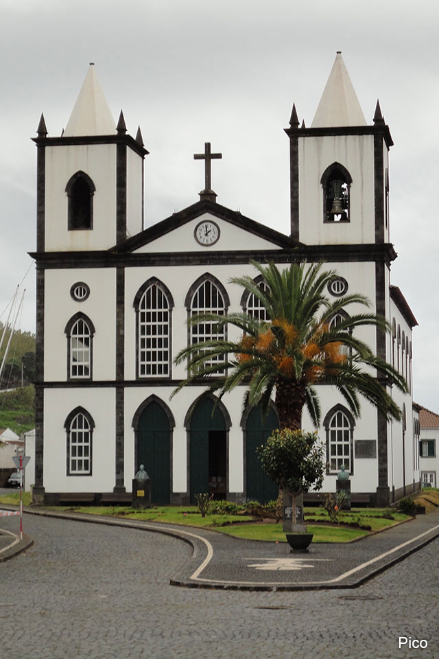
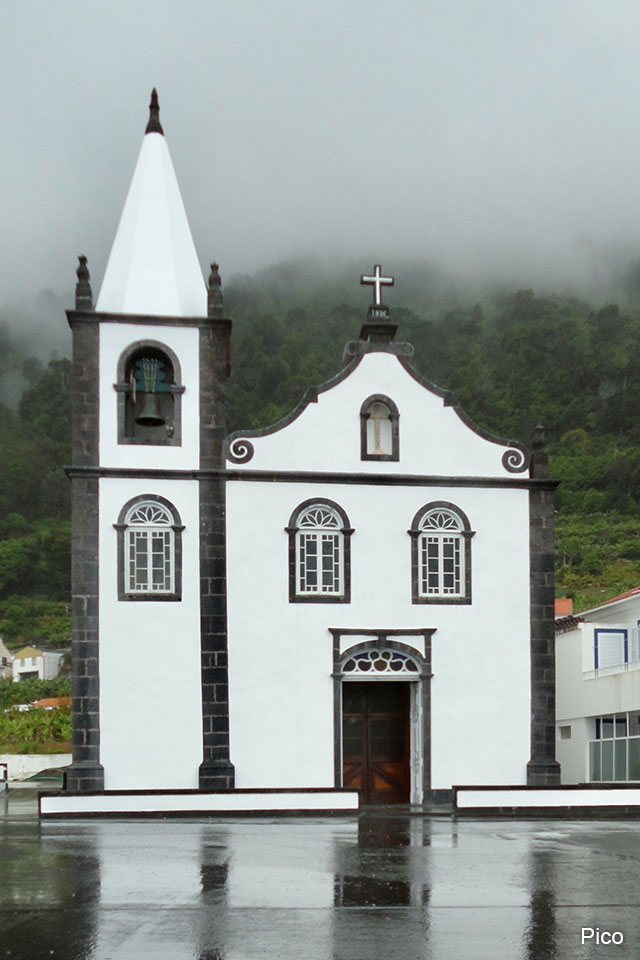
PICO
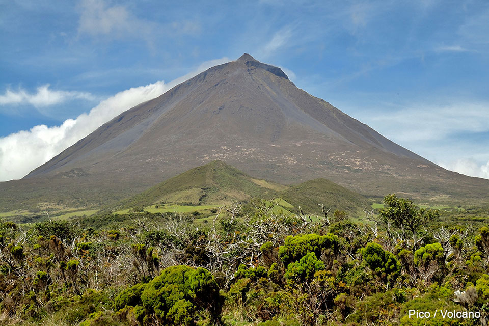
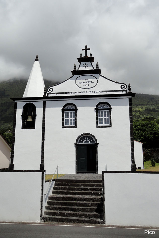
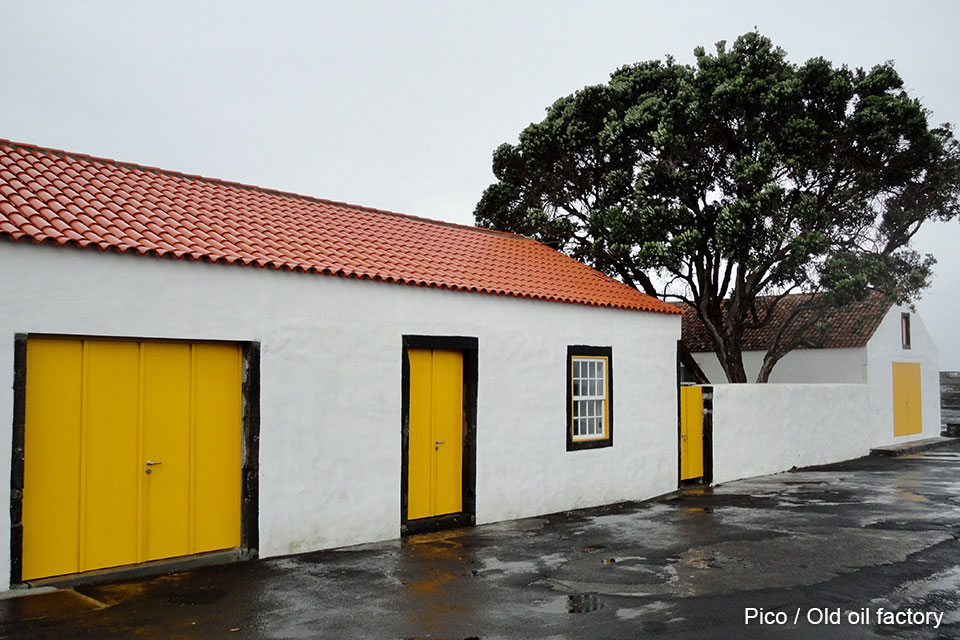
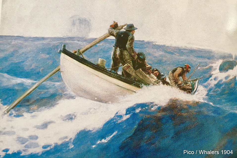
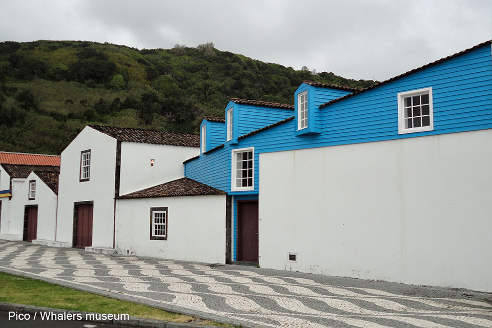
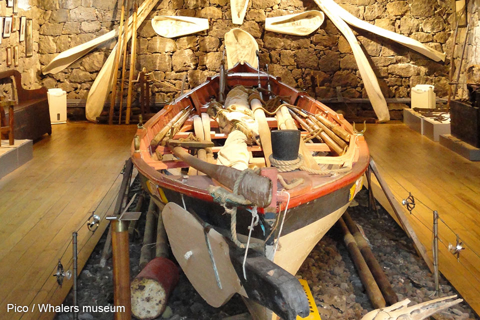
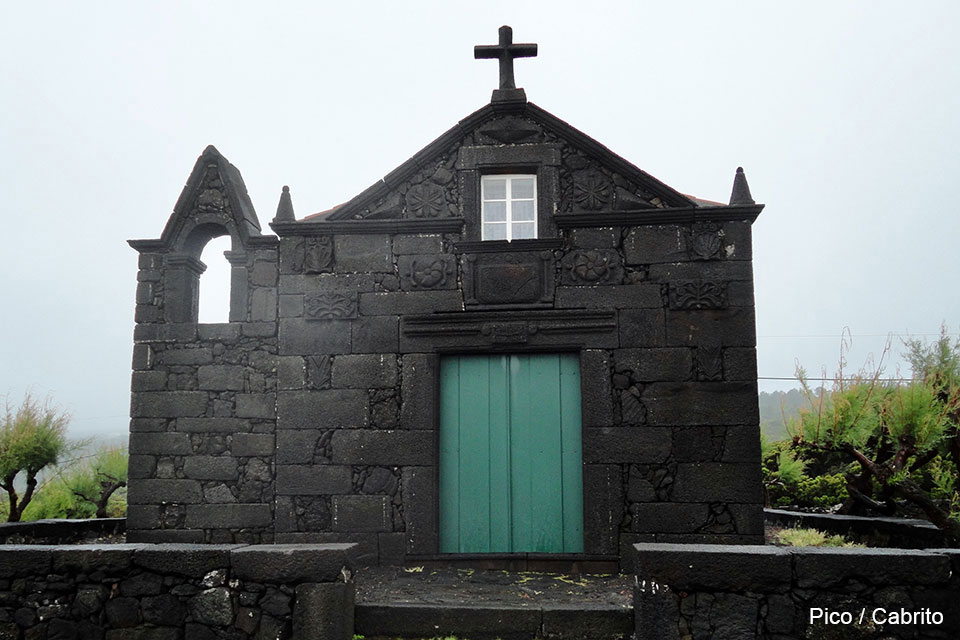
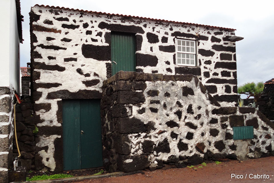
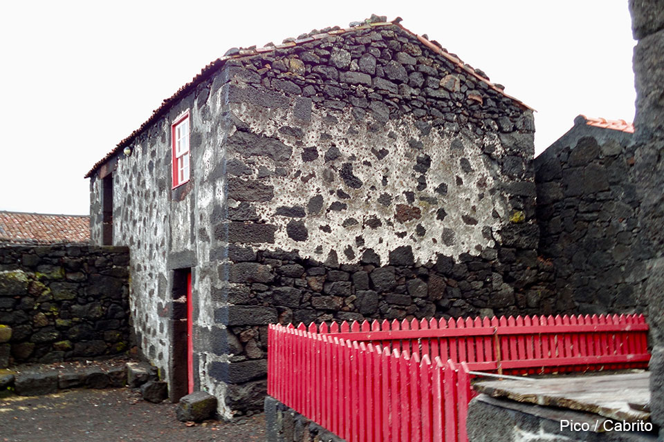
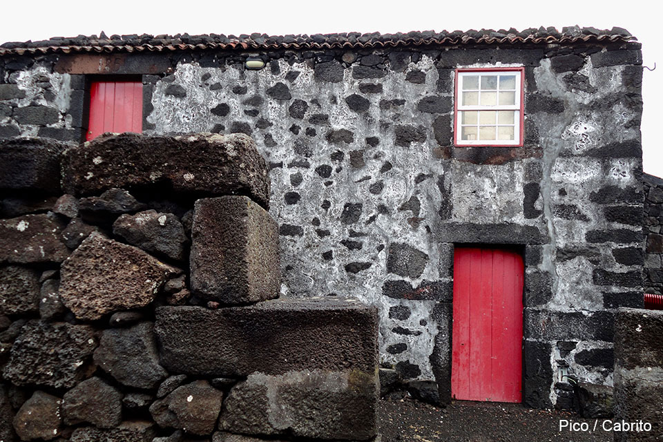
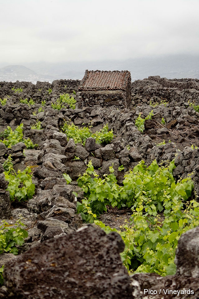
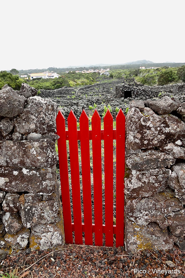
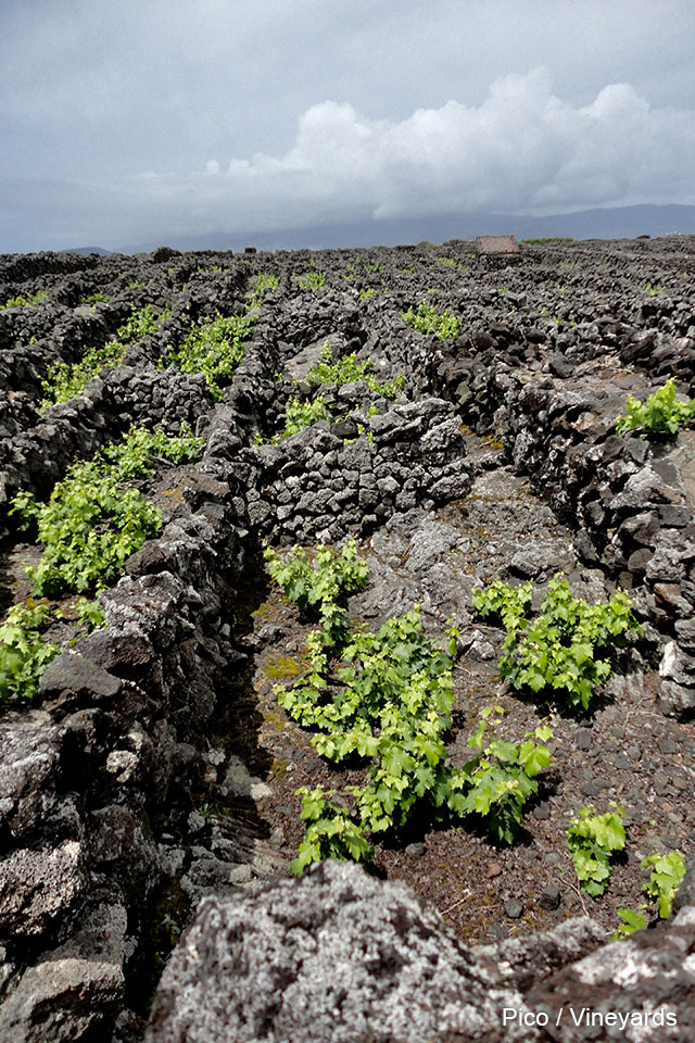
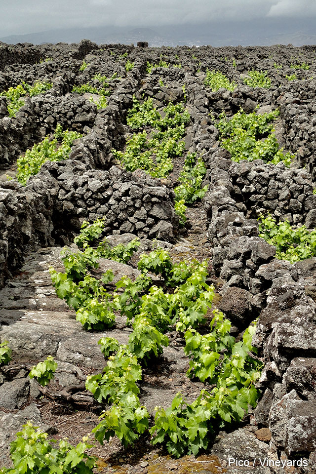
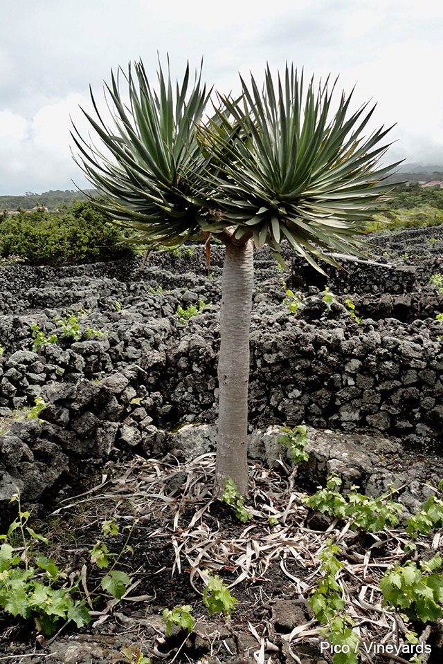
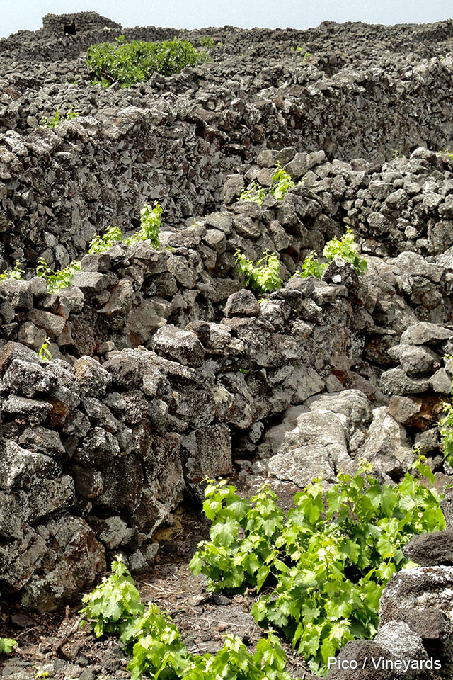
This island has a little drier weather than the other ones. Its enormus conical volcano (“Pico”) is visible from almost the whole island and also from the neighbor islands. It has 2400 m altitude and it is the highest moutain in Portugal (!). Sometimes from its upper mouth smoke strands emerge, evidencing the volcanic activity. This is the island that concentrated the ancient whalers activities. There is an interesting museum that shows this difficult job, that at the time was extremely lucrative. The modern architecture of the museum perfectly matches with the adjacent traditional constructions. Another distinctive feature of the island are the vineyards cultivated over the fields of volcanic rock. The delicious wine that is produced there is called “Verdelho”.There is a large number of churches on the whole island and there are villages (like “Cabrito”), with its houses and its churches, completely constructed with black volcanic rock.
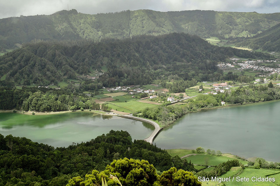
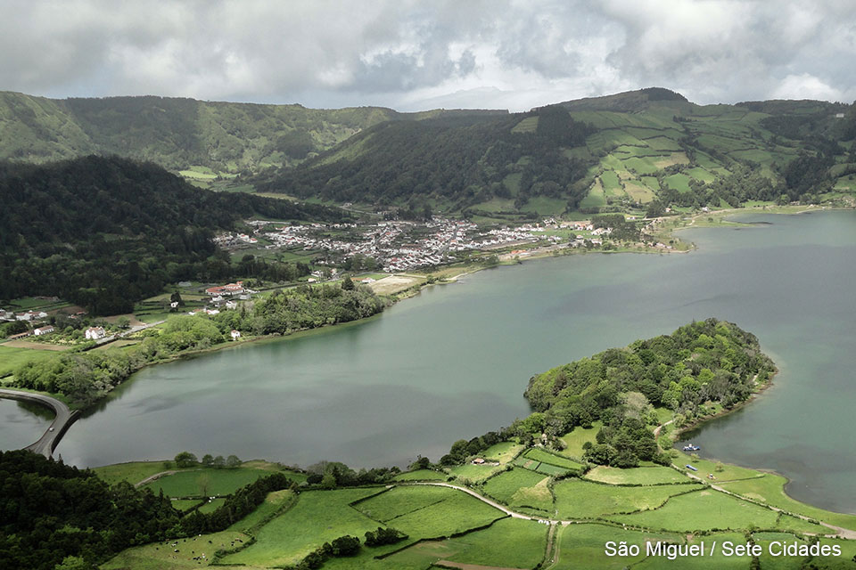
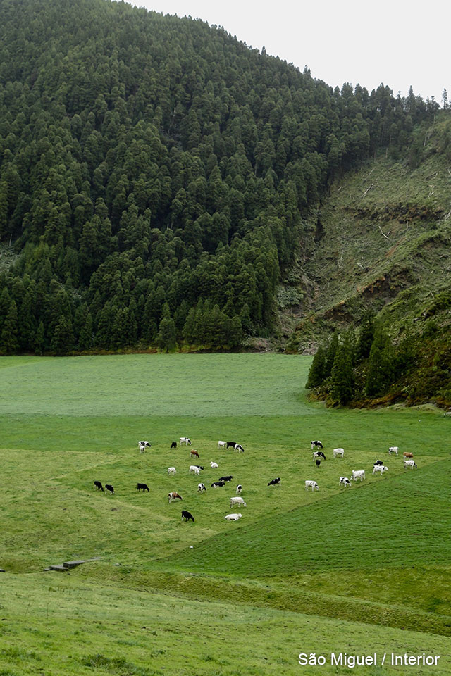
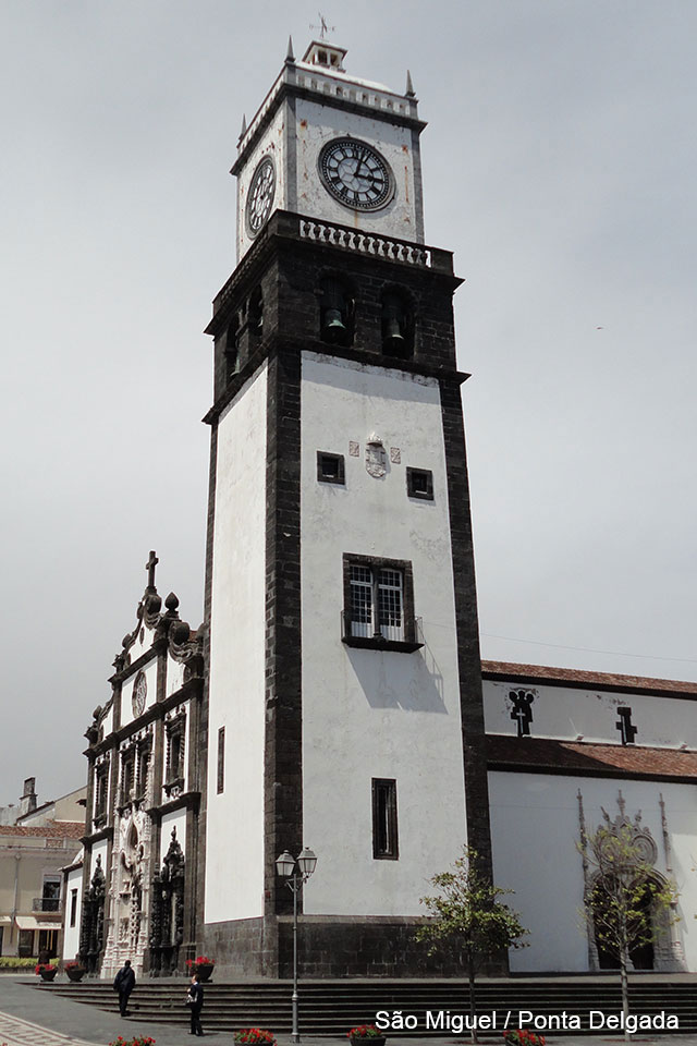
SÃO MIGUEL
Is the biggest and the more populated island of the archipelago. There are freeways and a lot of traffic and many tourists. In the central part of the island, there are a series of lakes surrounded by vegetation, that are ancient craters of extinct volcanoes.
Its capital (Ponta Delgada) is an active commercial port and has an important airport.
EL VIAJE DESDE LAS AZORES A MADEIRA
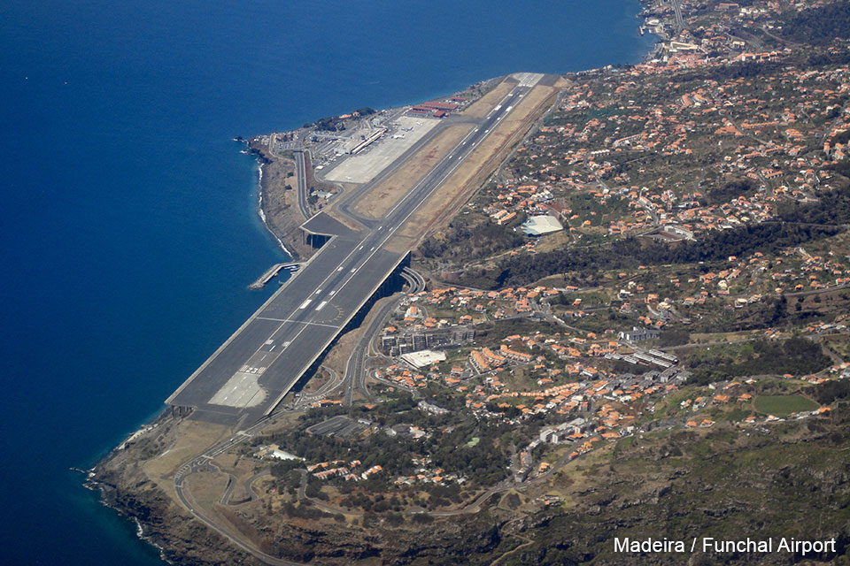
The final images correspond to the trip from Ponta Delgada to Funchal, in the island Madeira. This was a flight of almost three hours over the Atlantic Ocean in a twin-engine turboprop, that cannot fly at more than 7200 m altitude. Fortunately, the weather was good and the arrival in Madeira was spectacular, with an incredible view, before landing at the dangerous runway that looks like one of an aircraft carrier.