Gabriel Hakel travels to "Hakel Naturschutzgebiet" (Hakel: Nature Preservation Area), at Sajonia-Anhalt, to see what is about that strange place whose name coincides with his familiar surname.

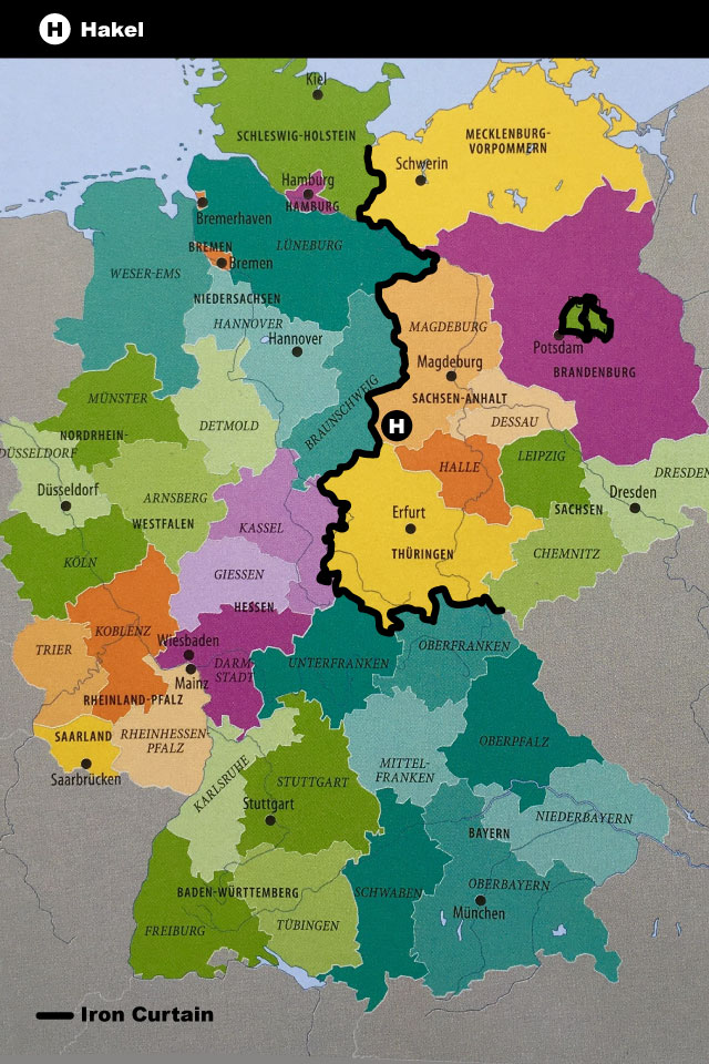
In 1964, when I was 14 years old, I was given the gift of the geographic Atlas of the “Brockhaus” German encyclopedia. In the back index, our surname “Hakel” appeared and it was shown in one of the detail maps of the German regions, with a different color from its surroundings. Nevertheless, it was not clear what this geographic element was. As the “Brockhaus Atlas” had been edited in the Federal Germany of those times, the political limits between Federal Germany and East Germany (DDR) were not expressed, probably encouraging the idea that Germany was a united entity. The only limits that could be distinguished were the ones between each of the “Landers” (provinces-states) that comprised the parts of both Germanies, and it was necessary to know which part of the borders of those provinces-states was the division between Federal Germany and East Germany (DDR) that, at the same time, was a border fixed by the “Iron Curtain” to separate both political blocs of those times.
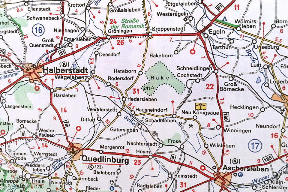
I confirmed that the “Hakel” was located in the Land (province-state) called Saxony-Anhalt, and that it was quite near to the border between both Germanies, but that it was just inside East Germany (DDR), thus in the communist area. Therefore, it was going to be a place almost impossible ever to visit. After the reunification of Germany, in 1989, I always thought about visiting that place, but there was no way to combine it with any of our trips because it was quite far away from our routes and from the airports with airlines connections. On Internet I found out that “Hakel” was a forest in an “area of nature preservation”, being the translation in German: “Natuschutzgebiet”. Only in 2017, returning with my wife from a trip from Sri Lanka (!) back to Argentina, we took that time to go to the “Hakel”; leaving and returning to Berlin on the same day, where we had made a stop in our returning trip to South America.

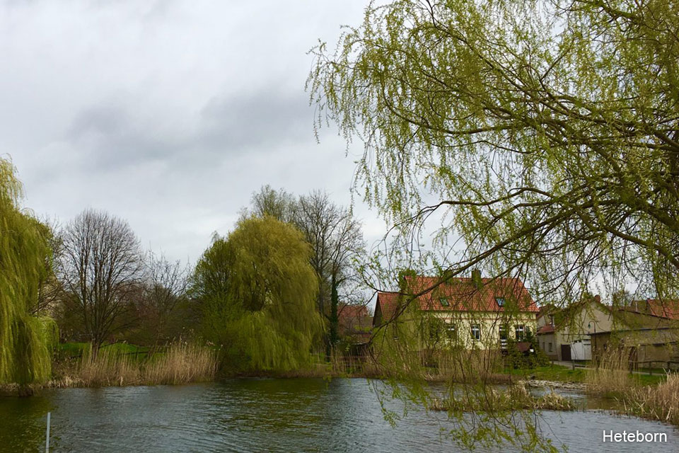
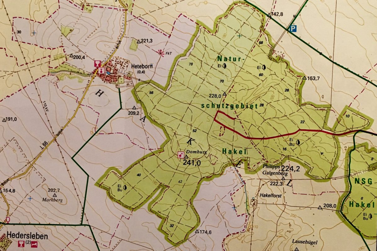
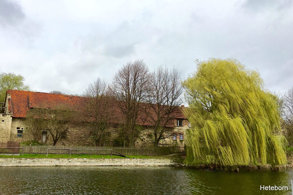
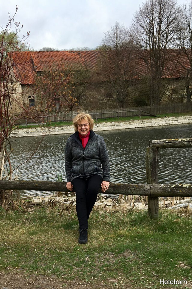
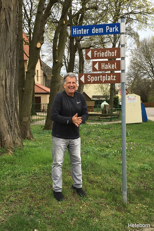
We knew that the nearest train station to the “Hakel” was in Halberstadt, but there was no certainty of how to reach from there to the “Hakel” and Google Maps was neither too clear about it. Luckily, in Berlin, we got the last copy of a map of the region, that had been printed for a biking association. In that map, we saw that the access to “Hakel” was from a small village called Heteborn. When getting off the train in Halberstadt we took a cab we hired. The driver of the Mercedes 350 (almost 0 km) had never been at “Hakel” and from Hetebornhe had only heard its name. When we reached Heteborn, we didn´t find anybody at the place. Absolutely anybody. We went around trying to find someone to ask, but with no success, until that -suddenly- in something like a square, signposting appeared:This way: to the cemetery; that way: to the playing field; this other way…:to the “Hakel”. Of course, we took the mandatory photos next to the sign with our surname and after ten minutes drive, we were at the entrance of the “Hakel” forest.
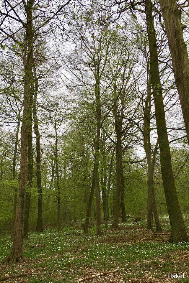
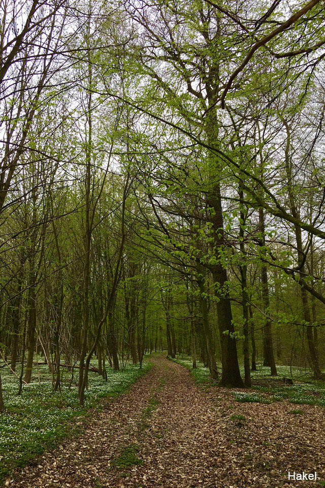
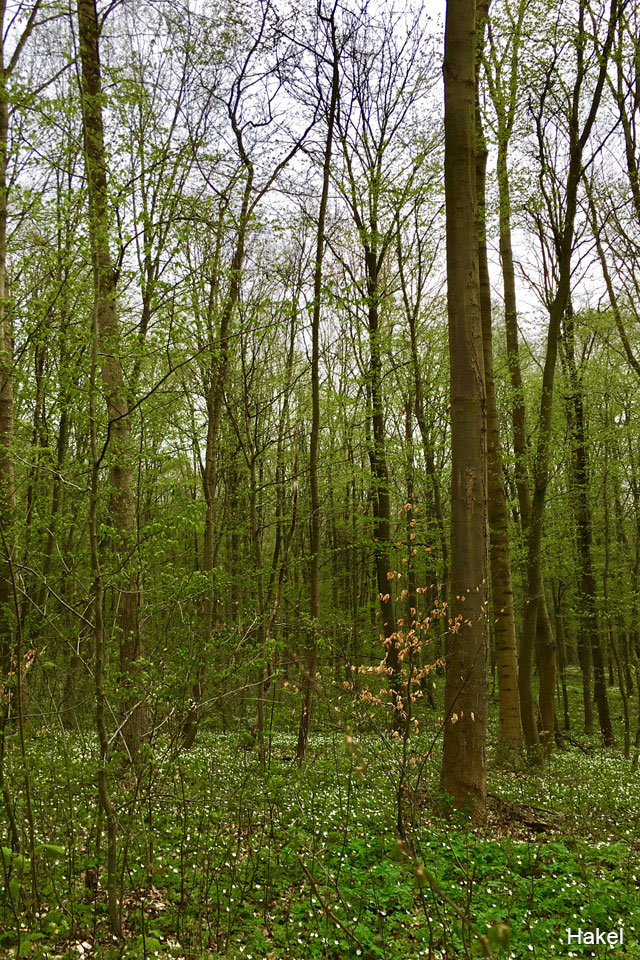
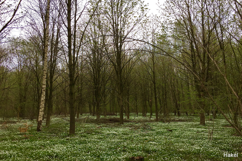
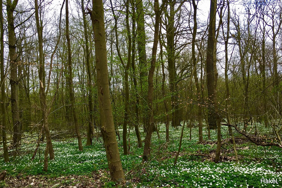
It happened to be a day at early spring, terribly cold and with a constant threat of rain. But it was the only day we had available. The entrance to the “Hakel” was a trail completely covered by the last dry leaves that remained from the recently gone autumn. We were absolutely alone driving through the place. The forest started blooming with different green tonalities. At both sides of the trail, the ground was covered with a thick grass with little white flowers that looked as frost. There was a complete silence and we felt happy of being at “our” forest. We walk through the interior paths and we were well oriented to get out. The driver had been nervous about that a tree branch could scratch his brand-new car, and he was anxious because we spent approximately two hours before we asked him to drive us from the “Hakel” to the small town of Quedlinburg that we wanted to visit, from where we would take the train back to Berlin.
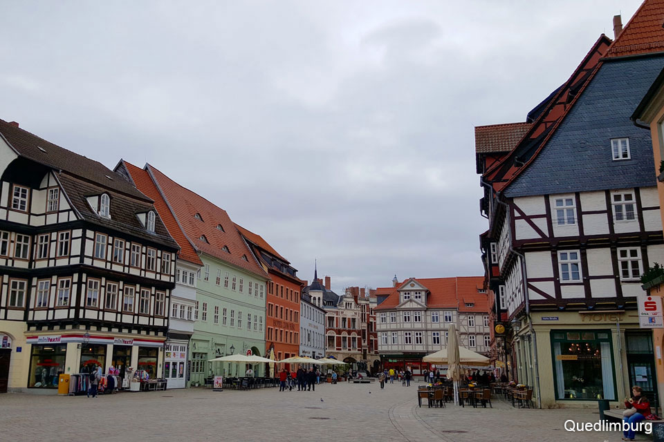
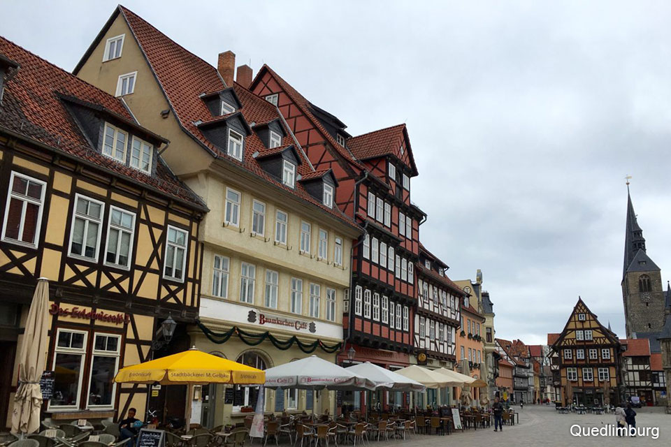
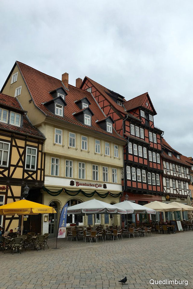
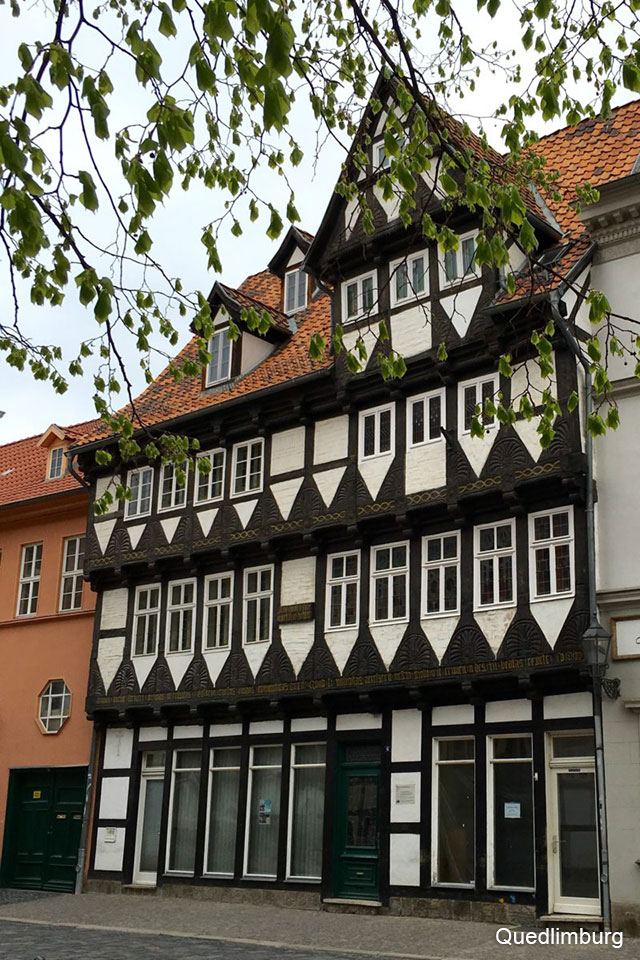
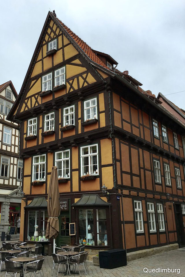
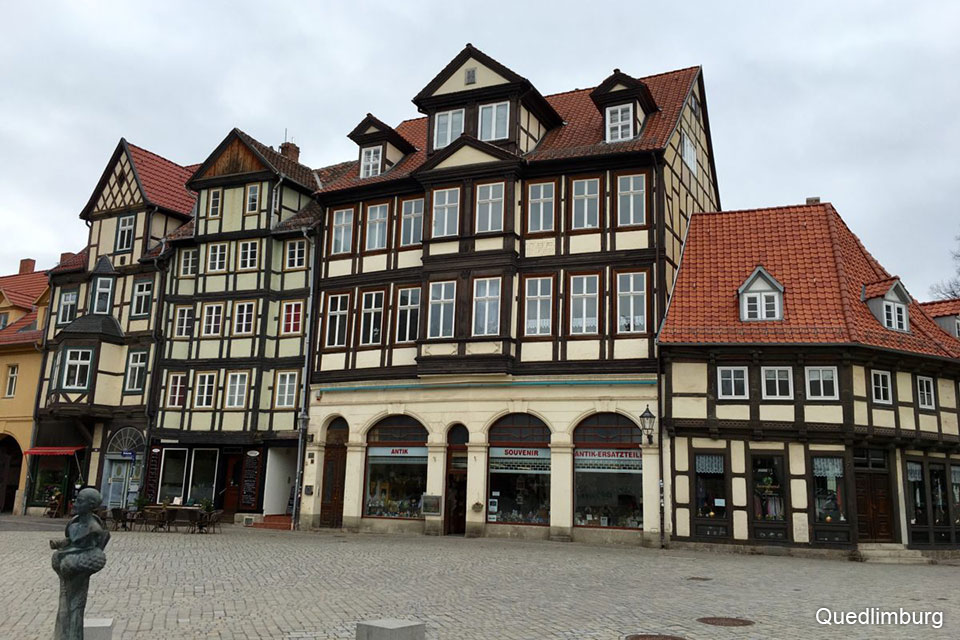
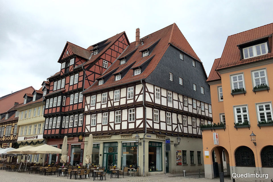
Quedlinburg is a small town that remained almost untouched during the Second World War and also during the years of the communist regime in that part of Germany. After the reunification of Germany, in 1989, its restoration began and, in 1991, it was declared by the UNESCO as a World Heritage Site. Generally, with that title granted by the UNESCO, the original residents see that their properties increase their value and so they put them on sale and move.
With this process, the original population is disappearing from the place. The ground floors of the empty houses are rented for commercial premises and the village starts to fill with souvenir shops and places to eat and so the original nature of the town turns into a sort of a tourist and cultural promenade. In spite of this,Quedlinburg is really beautiful, with a quality and quantity of urban situations that are a pleasure to walk through, contemplating the irregular (but perfect) proportions of the buildings, that are made with the Middle Age constructive techniques, when Quedlinburg belonged to the Hanseatic League.